How We Tackle Weeds in Organic Chickpeas
June 23, 2025We’re back in the field with our chickpea cultivation series! See how we tackle weeds after emergence using inter-row cultivation.
Read article
The fusion of drone technology and data analysis has led to significant advancements in precision agriculture to transform the way we monitor, analyze, and optimize crop growth.
In an era where technology is reshaping every aspect of our lives, the agricultural industry is no exception. The fusion of drone technology and data analysis has led to significant advancements in precision agriculture, and has changed the way we monitor, analyze, and optimize crop growth. Among these advancements, the creation and analysis of 3D models from drone footage have emerged as a powerful tool for farmers and researchers alike.

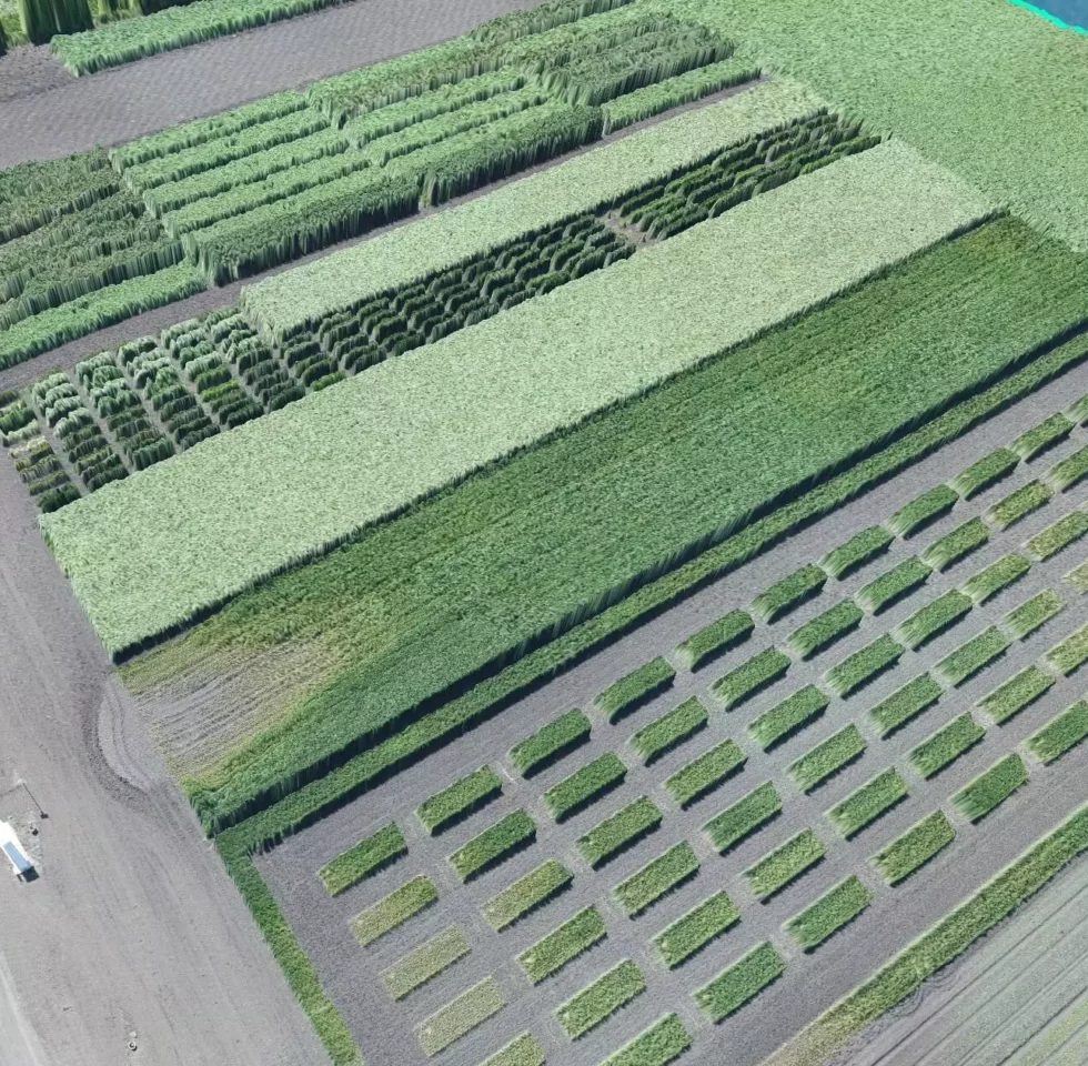
Drone footage has long been admired for its captivating visuals, but its practical value was often limited to simple imagery. However, a group of innovative minds at LoginEKO has harnessed the potential of drone-generated 3D models to uncover deeper insights into crop growth and enhance the efficiency of modern farming practices.
Traditionally, understanding crop growth involved manual measurements, tedious data collection, and substantial guesswork. Enter the era of drone-generated digital models of the surface. By combining data from various drone flights, the team embarked on an exciting journey to explore the possibility of measuring crop volume and height with unprecedented precision.
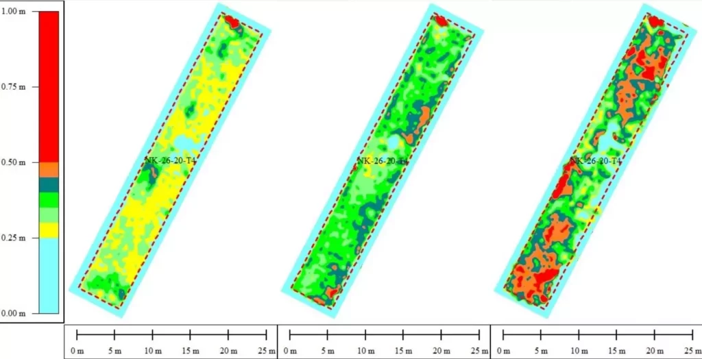
These digital models, generated using advanced software for manipulation of drone data and GIS (Geospatial Information Systems), captured intricate details about the terrain and crops. Through meticulous analysis, the team illustrated the evolution of crops over time, utilizing color-coded visuals to vividly depict the progress from bare land to thriving vegetation (see pictures below).
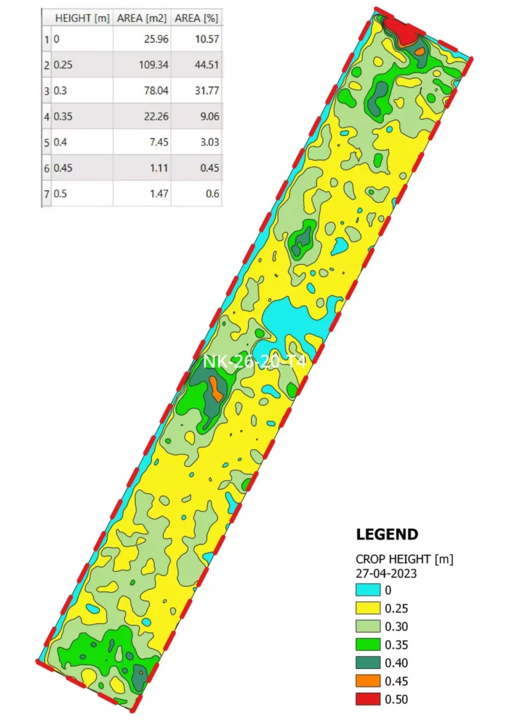
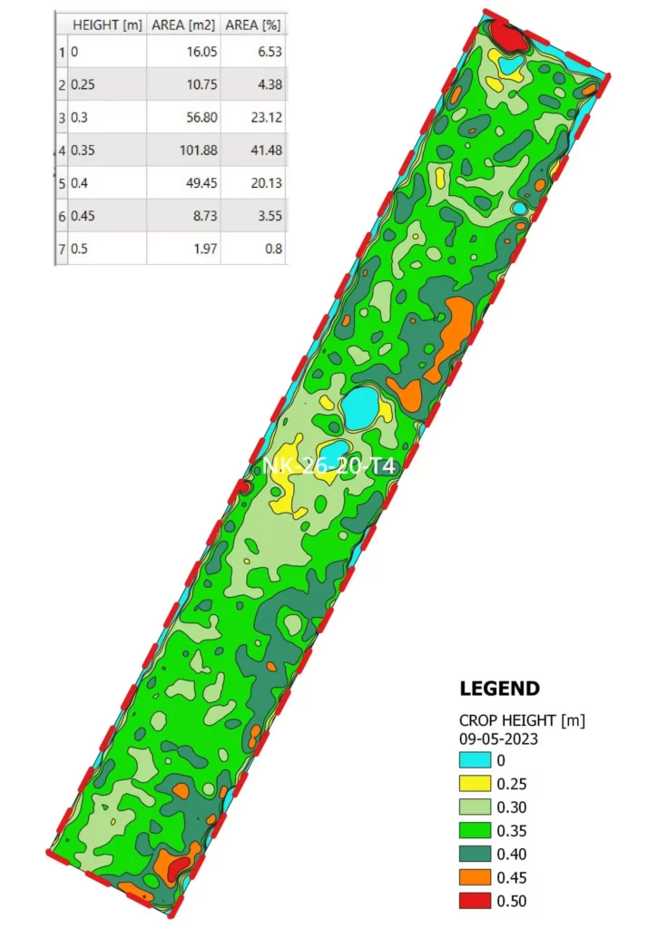
The journey began with the collection of baseline data, capturing the terrain’s initial state. Subsequent drone flights at key intervals allowed us to monitor the crop’s growth journey. We showcased the height and volume of the crops in a captivating longitudinal profile by meticulously overlaying these digital models and employing advanced analytical techniques.
To ensure accuracy, our team took samples from the field on specific dates, providing control points for our analysis. They effectively eliminated terrain irregularities, offering a clearer view of the crop’s height by isolating and projecting the crop’s features onto the baseline terrain model.
This methodology enabled us to classify crops based on height, generating a comprehensive visualization that unveiled the progression of the vegetation. The precise determination of volume and height at different growth stages provided crucial insights for informed decision-making in agriculture.
But the implications don’t stop there. We are committed to expanding the potential of our findings. In collaboration with the Green Manure Project Team, we expect to yield a more profound understanding of the relationship between crop mass, volume, and height zones. This knowledge promises to guide the application of green fertilizers, and to optimize their impact on the soil.
Moreover, we are exploring the integration of LIDAR (Light Detection and Ranging) technology to focus this precision even more. This advancement would allow for comprehensive data collection in a single drone flight, eliminating the need for a baseline measurement. The result? An enhanced, streamlined workflow that offers deeper insights without compromising accuracy.
In the realm of modern agriculture, data is the new gold. As drone technology continues to soar to new heights, our visionary experts are proving that the sky is not the limit. By harnessing the power of 3D models and innovative data analysis, we are unlocking the full potential of drone footage to revolutionize precision agriculture, and guide us towards a more sustainable and efficient future.

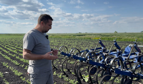
We’re back in the field with our chickpea cultivation series! See how we tackle weeds after emergence using inter-row cultivation.
Read article
Two days, three farms, one shared goal: growing hemp more sustainably. Here’s what we learned and shared during our tour of Prekmurje.
Read article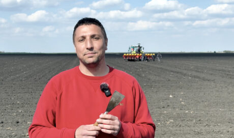
Chickpeas offer great potential for organic farming. Join us as we walk you through the essential steps of chickpea cultivation, starting with seedbed preparation.
Read article