LoginEKO Farming: Farm Map
Farm Maps empowers farmers with a comprehensive overview of their farm, allowing them to examine field details, plan crop rotation, monitor fields on the map, and make informed decisions based on the history of each field.
Latest news


Farming Software
Farm better with Farm Map
Farm Map simplifies precision field visualization, tracks changes over time, visualizes operations data, and monitors vehicle positions in real-time.
This user-friendly solution empowers farmers to gain a comprehensive understanding of their fields.
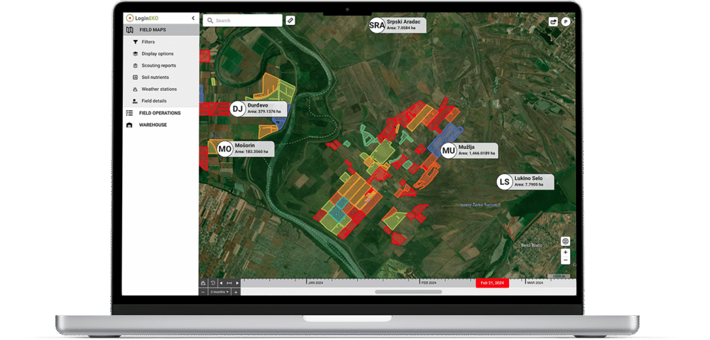
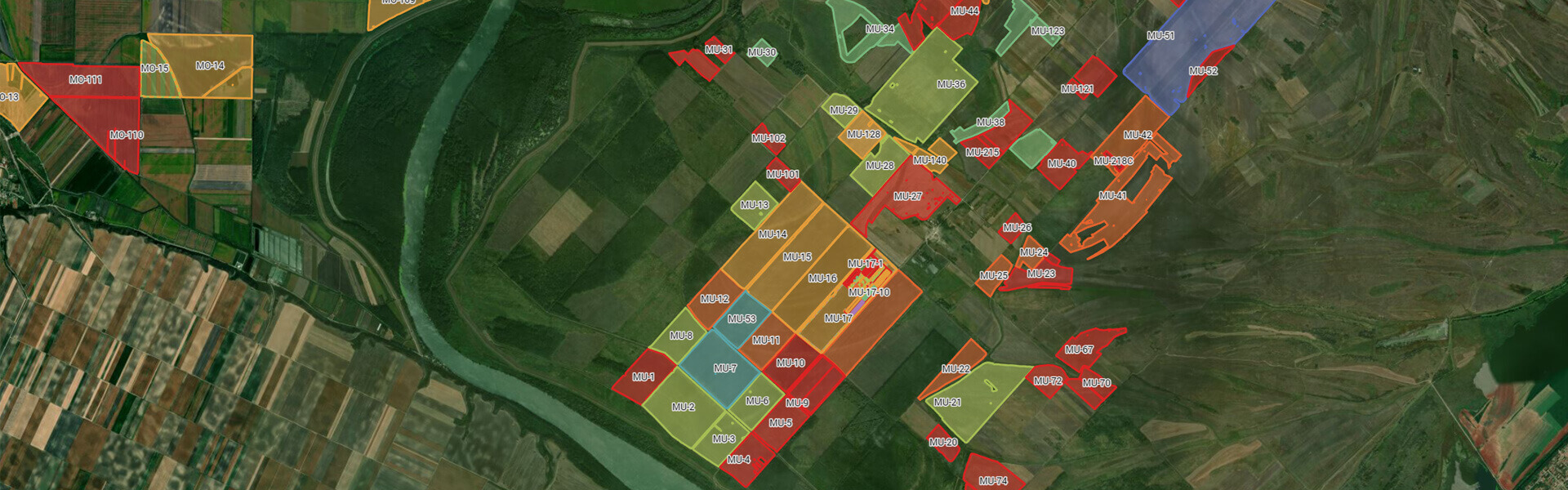
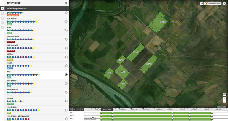
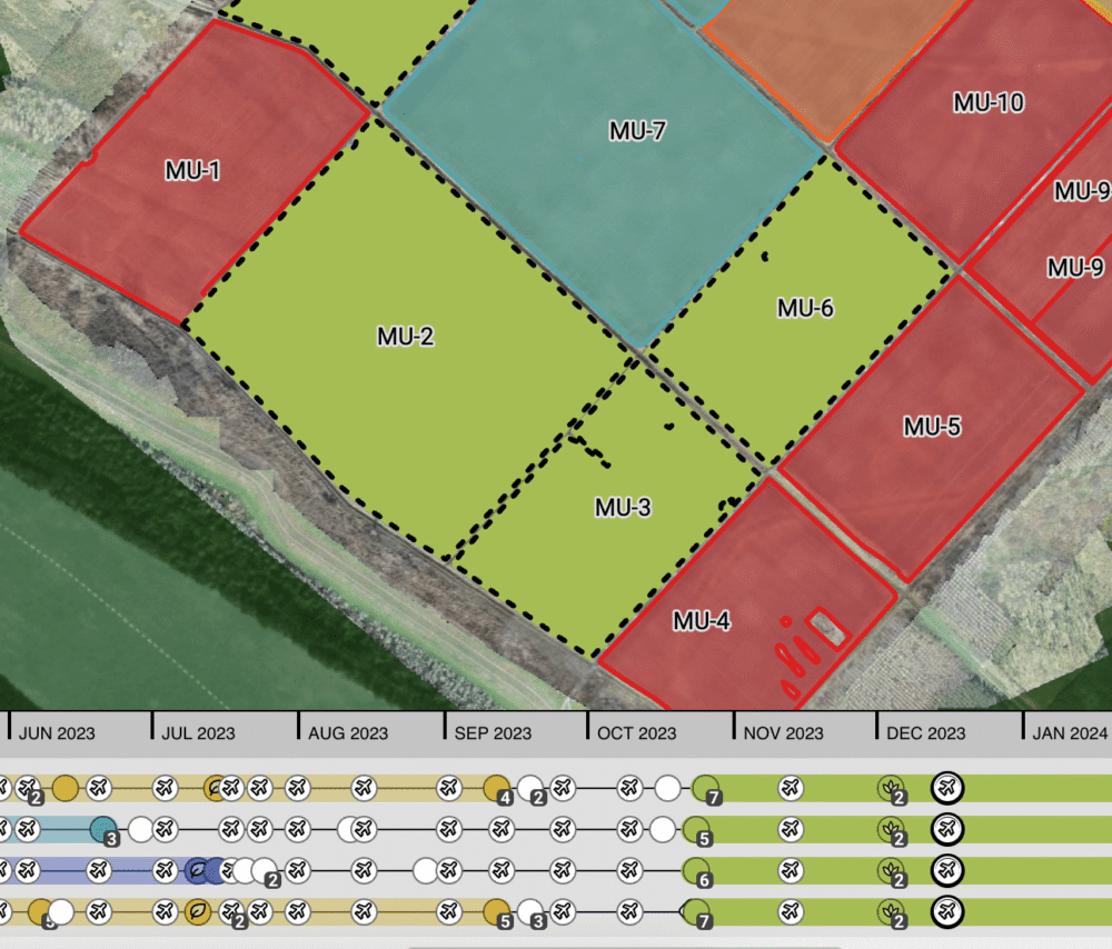
Visualize fields with precision
Farmers gain valuable insights into their farms by visualizing fields on the map with our software.
Our solution is capable of displaying farming fields, cadastre geometries, or any other custom geometries, providing a clear overview of the farm’s agricultural landscape.
Monitor fields over time
Our software enables farmers to track changes in fields over time with ease. The robust timeline feature allows for effortless navigation through seasons, facilitating the tracking of crop rotation and observing the progression of crops sown in each field. Additionally, farmers can review historical agricultural operations performed on the field, gaining valuable insights into the historical perspective of farming activities.
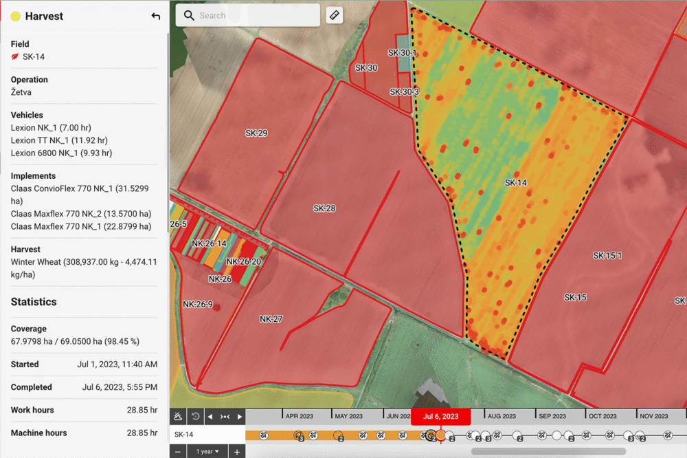
Visualize operations data
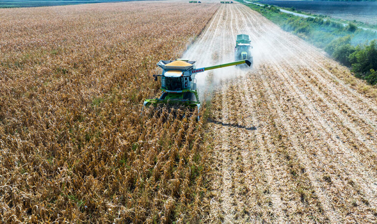
The map provides farmers with the ability to visualize precise operational data directly on the field, including seeding and harvest yield maps. These data are collected live during the execution of operations on the field, sourced from machinery telemetry or the Work Orders mobile application used by tractor drivers. This real-time insight enables farmers to make informed business decisions by truly understanding how their fields perform based on captured production data.
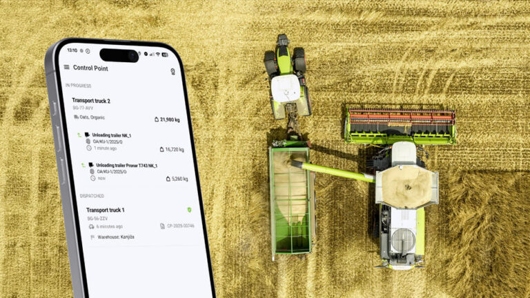
Track vehicle positions
The Farm Map module within our mobile app enables monitoring of real-time vehicle positions, tracking assigned tasks for each vehicle, and gaining visibility into the drivers behind the wheels. This comprehensive functionality enhances logistical efficiency, supports better-informed decision-making, and ultimately contributes to increased overall productivity on the farm.
Share field data
Publicly shareable links grant external parties access to comprehensive farm field data. This fosters trust among product buyers by showcasing field locations, current crops, ongoing operations, field nutrients data, live status updates, and planned operations. This feature not only provides a complete historical record of each field but also offers real-time insights into our production processes, giving stakeholders a transparent view of our operations.